Sunday, March 29, 2015

Central to Northern Bolivia

From Salar de Uyuni, our route took us to North to Sucré, visits to CrossFitters in Santa Cruz, long drives to La Paz and our final days in Bolivia were spent at Lake Titicaca in Copacabana.
Potosí - one of the highest cities in the world by elevation at 4,090m (13,400 ft.), long history of silver mining, and narrow streets with lots of cars going in every direction!  The van barely fit down a couple of these crazy alley-streets!


Sucré - a very pretty city comprised of whitewashed buildings and red roofs.  It was the city where Bolivia's independence was proclaimed.  We enjoyed the open markets and mix of modern and old traditional styles and dress. It is easy to see why many who visit end up staying for far longer than expected. We had the pleasure of chatting extensively with the Australian owner of Condor Cafe and Trekkers, who had this happen to him 7 years ago....and he is still there.
The region is more lush, reaching up into the mountains, with great treks and views of the high farmlands, ancient Inca trails and petroglyphs, and back roads deep into canyons and craters.


Maragua and the Inca Trail and Inca rock paintings
 - We tried to drive to the Maragua crater and had a true adventure of driving some narrow dirt roads turned to mud in the pouring rain.  The inclement weather caused us to pause and reconsider, as that sticky mud filled in the tread of our tires and we found ourselves sliding backwards toward the steep dropoffs at the side of the road.  We stopped and waited out the rain and thankfully Mr. Sun came out and dried the clay a bit.  Enough for us to scrape it off the tires and find a bit of purchase to climb our way out of there.  Maragua crater, you will be had another day...
The wet and winding road that was our demise...


- We hiked a portion of the pre-Hispanic trail that runs from Chataquila to Chaunaca, a segment of road that formed part of a huge network of trails which extended throughout Bolivia and southern Peru during the Incan empire.


- Another trek took us to the mysterious rock paintings of Puma Mach'ay and Inka Mach'ay.


North on the road to Santa Cruz, we have been left with permanent brain damage, due to insanely rough roads!  Indescribable and the worst roads we have encountered yet!  12 hours of being jarred to the bone was .... exquisite.


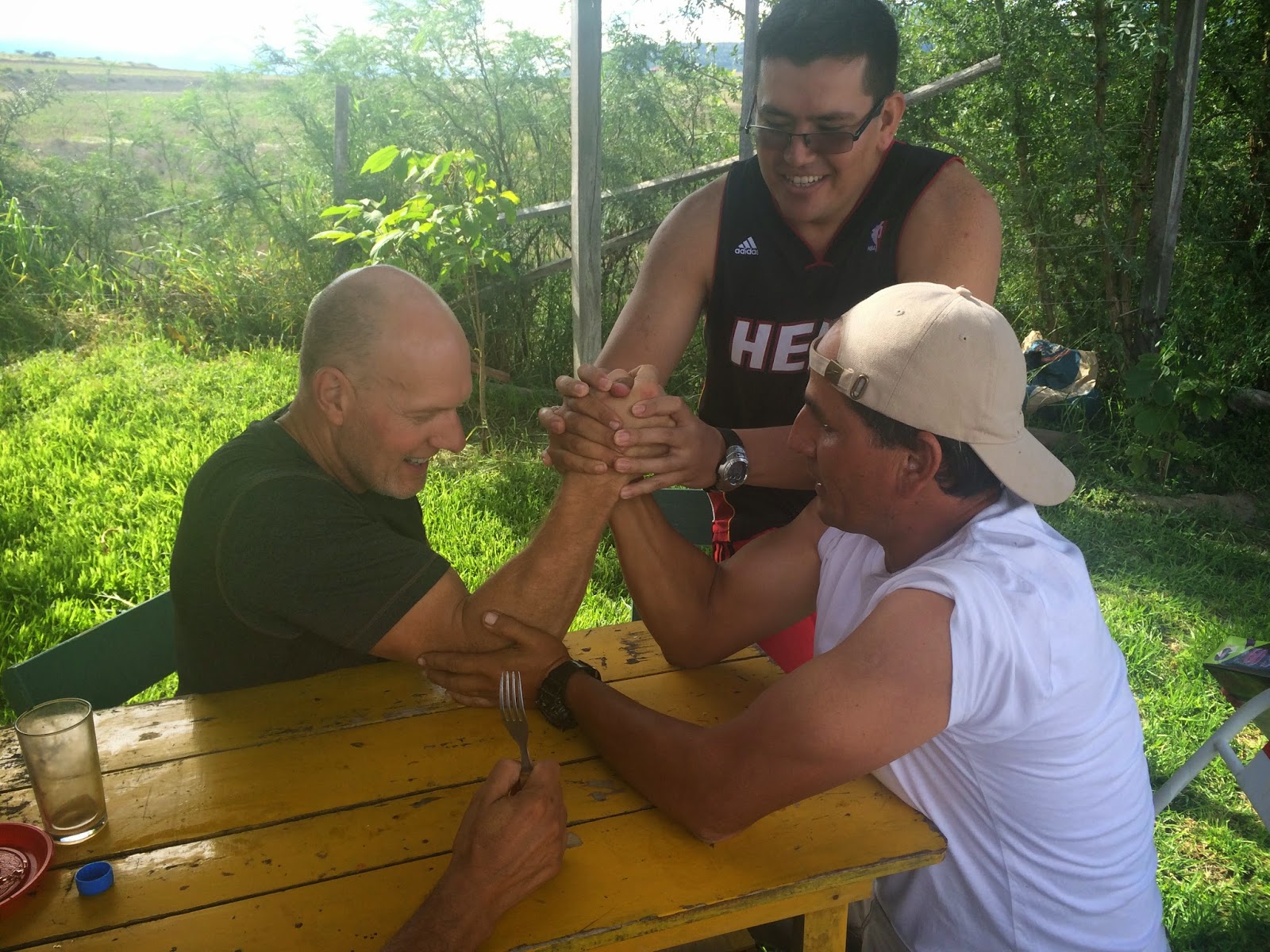
Santa Cruz and our CrossFit friends!
To be able to cross into Bolivia, we had to have a visa.  This was a challenge to get and the thing that made it easier was letters from people we had never met, but we knew would be of gracious service to us.  If it weren't for the ever welcoming CrossFit community, friends we have yet to meet in many places across the world, we might not have had some of the opportunities we have.  Big thanks to Marcelo at CrossFit Redención and María Jesús at CrossFit Muf!

Santa Cruz, the largest city in Bolivia, is very tropical and internationally diverse.  We enjoyed all the tropical plants, multitudes of butterflies and birds, great food, and some great workouts in and out of the gym!


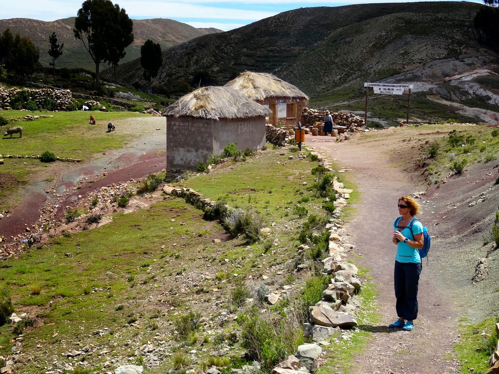
Lake Titicaca - We finished our Bolivian tour with the world's largest high-altitude lake, sitting at 12,500 ft.  Staying in Copacabana and taking a boat to Isla del Sol for a great hike exposed us to a lot of the local culture and native dress.  Beautiful people!
Lake Titicaca is a sacred place for the Inca civilization, being credited for the start of their civilization.  The Incan mythology says that the first Inca king was born here. -Lonely Planet
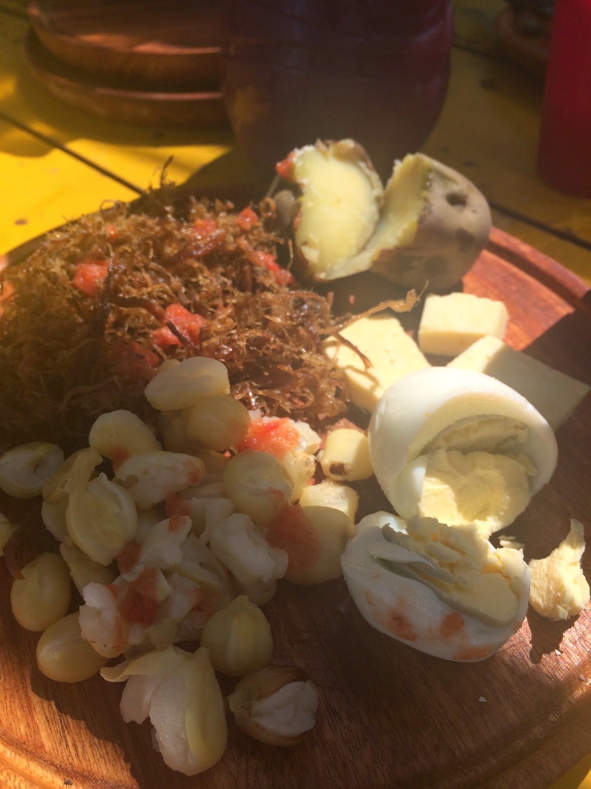


 We loved Bolivia!!! 
Photo Album HERE

Saturday, March 28, 2015

Natural Disasters In Our Wake

We have had particular interest in recent current events in Chile, due to the impact they are having on places we have been as recently as 3 weeks ago!

In my previous post about the Atacama, I talked about how "the annual rainfall (or lack of it) defines a desert, but that doesn't mean that it never rains in Atacama. Every so often a warming effect over the Pacific Ocean around the equator changes the weather the world over and even places like the driest desert in the world can become doused with drenching storms."  One such of those storms has been pounding the Atacama Region this past week.  It's incredible to watch the footage of streets we walked, towns we visited, and landmarks we recognize be completely submerged and turned into torrential muddy rivers where only dry sand and red dirt existed just a few short weeks ago.

Atacama Desert flooded after 7 years of rain fell in just 12 hours  -The Watchers News

In other news, in early March Volcan Villarrica erupted. A mountain we climbed in Southern Chile in November! It is showing signs of further activity this week. We are glad we got up on it before she woke up!

Chile's Villarrica volcano spews ash in renewed activity -Daily Mail and BBC News

Monday, March 16, 2015

Hail Bolivia!

Our route through Southern Bolivia, from the border to the Salar de Uyuni
We crossed the bridge and into Bolivia, not really knowing what to expect.  We had heard so many stories about how wild and untamed this country is.  And it has ended up being our favorite for those reasons.  We have stepped back in time in many ways.  The internet is as rare as a paved road and most homes are built from hand cut clay bricks.  It was refreshing to see the simplicity of living, the beauty in the spareness of many of these villages.

The road from Bermejo to Tarija, our first experience of the country, was a perfect introduction.  1-2 lanes through the forest, along steep cliffs that were sliding and letting loose a lot of rock fall, having just come out of the rainy season.   It made for an exciting journey in the dark to reach Tarija, where we thankfully had a new friend awaiting us!


We met Jorge at a Level 1 seminar in Buenos Aires in February.  He was so excited to hear we would be coming to his country and has been an incredible resource and tour guide for us!

Tarija

is one of the prettiest regions of Bolivia. It has valleys, low mountains, forests and plains with a wonderful temperate climate. It is also home to some of the highest vineyards in the world.  We toured several wineries, enjoyed award winning wines, and experienced Singani, a pomace brandy distilled from white muscat grapes. It is produced only in the Bolivian Andes and is considered the national liquor of Bolivia.


THE LOCAL EXPERIENCE OF FAMILY -
We had the special privilege of being invited to share a family event with Jorge's family at their country home.  They have their own vineyards and it's the end of the season.  We picked grapes, ate traditional Bolivian food - a chicken based soup call Sopa de Mani, Charkekan - llama served with hominy, cheese, an egg, and potatoes.  We drank wonderful local wine, local beer, and Chicha - much like Sangria.  There was, in fact, NO water available that day! Ha!  That is probably what led to all the shenanigans of arm wrestling and lots of banter and laughter with our new friends.


The llama was prepared much like pulled pork, but drier.  Delicious!
Ernesto, our wonderful host, toasting Mike that he will have children as a result of this day....ha.
Traditional grape picking hats were in order!


The road from Tarija to Tupiza was a 6 hour rough dirt road with steep climbs to 13,800 ft. elevation.  Unfortunately, the van engine didn't do well again at elevation and we died several times out there.  We were entertained by peeping goats and dueling cows in the sunset, and finally found a place to pull over and let the van rest for the night.  We were able to go on the next day and made it the rest of the way without incident.  Unsure what the issue is - perhaps the O2 sensor?


Tupiza market shopping.
If we thought the road between Tarija and Tupiza was rough, we hadn't seen anything yet!  The road from Tupiza to Uyuni made us dizzy with the washboard, washed out roads, and potholes!  But the reward for that beating was the Salar de Uyuni.  Absolutely our favorite sight thus far on our trip.


Salar de Uyuni

is the world's largest salt flat at 10,582 square kilometers and is at 3,656m elevation (12,000 ft.)
The salt is over 10 meters (33 ft) thick in the center. In the dry season, the salt plains are a completely flat expanse of dry salt, and the salar is a pure white expanse of the greatest nothing imaginable – just blue sky, white ground and you.
In the wet season, it is covered with a thin sheet of water that is still drivable.  When there’s a little water, the surface perfectly reflects the clouds and the blue sky, and the horizon disappears. If you’re driving across the surface at such times, the effect is positively surreal.
We hit it at the end of the wet season, so we were able to experience both situations on the salt flats, though they were mostly dry where we were.


Camp for the night.


Isla Incahuasi - cactus covered Island in the midst of the Salar
Quechua for Inca house, so-called because of a stone structure, believed to have been a rest stop for ancient traders crossing the salar.


Salar de Uyuni brine and 9 months of grime needed to come off!  The van got a well needed bath in Uyuni, before we head North to Sucre!

View the entire South Bolivia/Salar de Uyuni Flickr photo album HERE